Stephen H. Long Trail 1819 — 1820
Day 15: September 7th, 2008 Denver — Monument


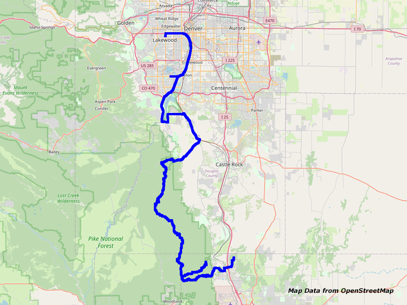
Map Denver to Monument
Again I wake up around half past six. My ear plugs work really well because I have heard nothing of the nearby Interstate. But again, the left one has been fallen out of my ear.
First I hurry up to get under the shower. Then I pack my stuff together. Around a quarter past eight I put my stuff into my truck. While doing this, two policemen pass me with a prisoner. It seems like they have just arrested him. Lucky me, everything is fine at my truck.
When checking out I ask for a nice breakfast restaurant and they recommend the Westwood Inn just across the street. This I haven’t seen yesterday. I say thank you and drive over to the restaurant. It is a nice and small family restaurant where you can pick your table by yourself. The price is really good and the coffee service is excellent. However, you don’t receive a check at your table but you just walk over to the cashier. This I remember from areas, where a lot of Mexican people live. There it is usual to walk over to the cashier without receiving the check first. As it seems that this restaurant is also run by Mexicans, this is probably also over here like that.
I pay and walk over to my car. There I mount all my equipment. Just across the street is a gas station which I will visit. But somehow the pump is not working correctly. After 0.045 gallons it stops and there is no chance to get it working again. So I can just stop here and walk over to the employee inside to let him know. However, nobody is there. Therefore I drive on. At the Conoco I have no issues and can gas up. Around half past nine I am on the road again.
First I take Highway 6 to I–25. Then I continue on Highway 85 and later on Highway 75. While trying to reach the latter I get lost once again because I miss the waypoint at my GPS software. Therefore I must turn around and drive back.


Highway 85, Denver, CO


Highway 470/121/S Wadsworth Blvd, Denver, CO
Then I take Highway 75 to the South Platte Canyon. But the road is closed. You would be forced to take all the way by foot. That is not really what I want, walking on forest roads. Above all, the parking lot is really crowded and almost no space available.


Highway 67, CO
So I skip this part and drive directly on Highway 85 to Highway 67.


Highway 67, CO


Rampart Range Rd, CO
From this one I can exit to Rampart Range Road. The speed limit on this road is 20mph. But it seems no one is really taking care of this. You can tell that it is Sunday today. There is a lot of traffic on this road. Additionally, this road is also one of these typical washboard roads. Anyway, I still make good progress and around noon I am at the trailhead of Devil’s Head Lookout.


Rampart Range Rd, CO


Devils Head Lookout Trail, CO


Devils Head Lookout Trail, CO


Devils Head Lookout Trail, CO


Devils Head Lookout Trail, CO


Devils Head Lookout Trail, CO


Devils Head Lookout Trail, CO


Devils Head Lookout Trail, CO


Devils Head Lookout Trail, CO
The parking lot is pretty full. But I still find a nice spot. Before I start my hike I put some sunscreen with sun protection factor 12 on. When walking the incline you can tell that the height is really taking you out. You start to loose breath way sooner as usual. There are a lot of people coming towards me, a lot of them tourists who not even greet back. After almost an hour of hiking I arrive at the stairs to the fire lookout tower.


Devils Head Lookout Trail, CO


Devils Head Lookout Trail, Pikes Peak, CO


Devils Head Lookout Trail, Pikes Peak, CO


Devils Head Lookout, CO


Devils Head Lookout, CO


Devils Head Lookout, CO


Devils Head Lookout, CO


Devils Head Lookout, CO


Devils Head Lookout, CO


Devils Head Lookout, CO


Devils Head Lookout, CO


Devils Head Lookout, CO


Devils Head Lookout, CO
These are very steep stairs mounted pretty adventurous in the rocks. This is definitely nothing to do for someone who is afraid of heights! There are great views of the whole mountains around from the fire lookout and I am able to get some really nice shots. You even receive a small card that you have been up there from the ranger on duty.


Zinn Memorial Overlook, Pikes Peak, CO


Zinn Memorial Overlook, CO
On my way back I do a brief side trip to the Zinn Memorial Overlook where you get a nice view of Pikes Peak. Then I hike back to my car. Around 3pm I arrive there and continue my journey.


Rampart Range Rd, CO


Rampart Range Rd, CO


Rampart Range Rd, CO


Rampart Range Rd, CO


Rampart Range Rd, CO


Rampart Range Rd, CO


Rampart Range Rd, CO
On Rampart Range Road I continue to Balanced Rock Road. My planned exit to Mt. Herman Road is unfortunately closed, so I am not able to drive this road from there. But instead I drive the Balanced Rock Road to its very end.


Balanced Rock Rd/FR322, CO


Balanced Rock Rd/FR322, CO


Balanced Rock Rd/FR322, CO


Balanced Rock Rd/FR322, CO


Balanced Rock Rd/FR322, CO


Balanced Rock Rd/FR322, CO


Balanced Rock Rd/FR322, CO


Balanced Rock Rd/FR322, CO


Balanced Rock Rd/FR322, CO


Balanced Rock Rd/FR322, CO


Balanced Rock Rd/FR322, CO


Balanced Rock Rd/FR322, CO


Balanced Rock Rd/FR322, CO


Balanced Rock Rd/FR322, CO


Balanced Rock Rd/FR322, CO


Balanced Rock Rd/FR322, CO


Balanced Rock Rd/FR322, CO


Balanced Rock Rd/FR322, CO


Balanced Rock Rd/FR322, CO


Balanced Rock Rd/FR322, CO


Balanced Rock Rd/FR322, CO


Balanced Rock Rd/FR322, CO


Balanced Rock Rd/FR322, CO


Balanced Rock Rd/FR322, CO


Balanced Rock Rd/FR322, CO


Balanced Rock Rd/FR322, CO
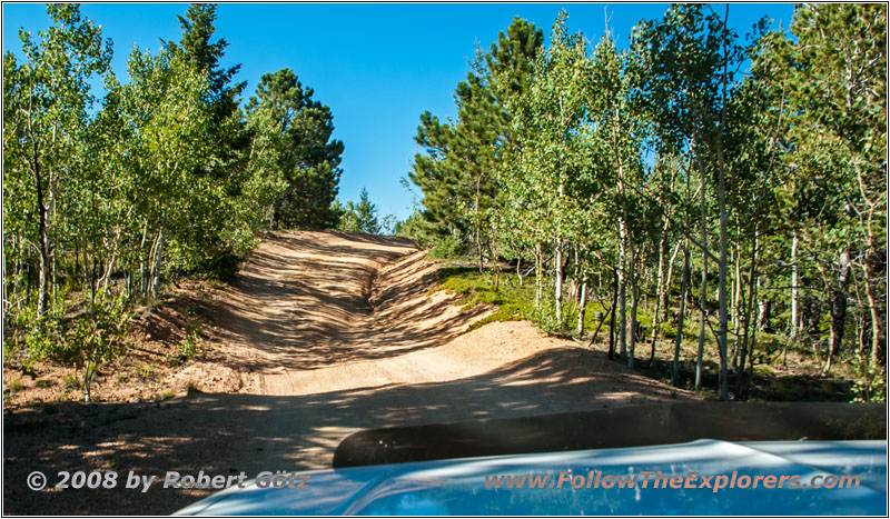
The road is pretty good to drive. You only need to take care of the deep washouts. And also the height of my truck is causing sometimes issues, because my CB antenna got caught at branches many times.


Balanced Rock Rd/FR322, CO


Pikes Peak, Balanced Rock Rd/FR322, CO


Pikes Peak, Balanced Rock Rd/FR322, CO
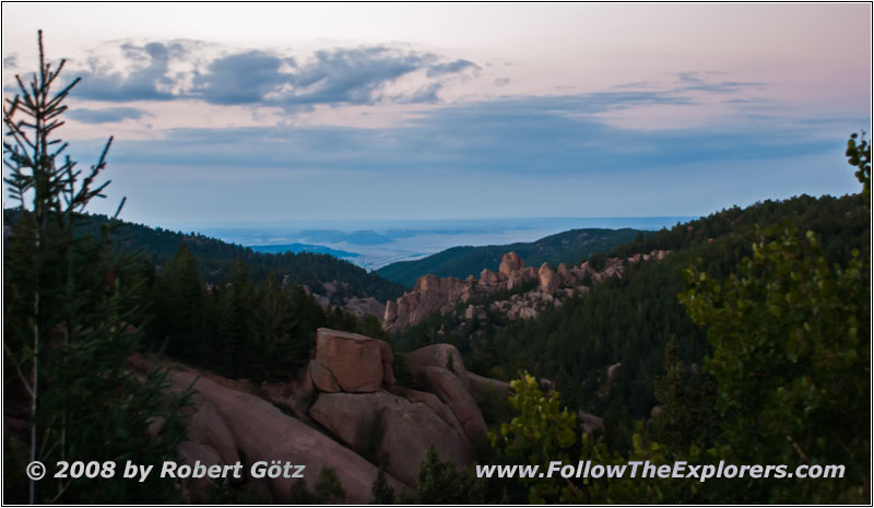
Around 6pm I arrive at the end of this road. There I quickly take some pictures and videos. In the meantime it is getting dark. But even with all the forest around me I am able to get a nice sunset shot of Pikes Peak. Then I start my drive back. But soon after my departure I almost get stuck at a washout. I simply was not taking care and approached it completely straight. This even stalled my engine. Lucky me, I am able to get out of this ditch with enough throttle. There I was really lucky!


Rampart Range Rd, CO
Then I drive back to Rampart Range Road. On this I continue for a short drive before I reach Mt. Herman Road. On this one I will stay until I reach Monument.


Mt. Herman Rd, CO


88 S10 Blazer, Mt. Herman Rd, CO


Mt. Herman Rd, CO


Mt. Herman Rd, CO


Mt. Herman Rd, CO
My journey continues and slowly the cities down in the valley get really nice illuminated. There I try my luck with the new camera. But without tripod I have no chance to get a nice picture with these long exposure times. Therefore I get my tripod out of the truck and now it seems to work out! I am really keen to see how these pictures work out on my laptop!
Around a quarter past eight I finally arrive in Monument. Now I follow the directions of my navigation software until I arrive at Harv’s house. However, the software sends me to their neighbors. But the lady living there is able to help me out.
Finally I arrive at the correct house. The hello is really warm and hearty and the house is very nice. For dinner we have lasagna and a piece of cake with tea as desert. We talk a lot about trails and also about tomorrow. There we have the plan to go out for breakfast all together and really take our time.
Around half past ten I walk into my guest room and write my diary until half past eleven. Then I quickly download the pictures from my camera before I fall dog–tired into my bed. The height is really taking me out because I have terrible headaches in the meantime. Even the Ibuprofen haven’t helped much yet…
- Sights
- Devils Head Lookout
- General
- Breakfast: Westwood Inn, Denver
- Dinner: Harv &Barb, Monument
- Motel: Harv &Barb, Monument
- Distance: 119 miles
