Stephen H. Long Trail 1819 — 1820


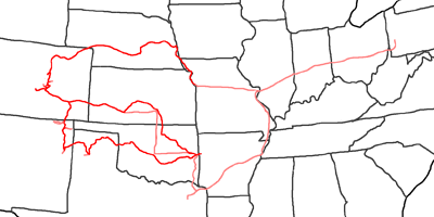
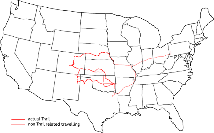
Map of Stephen H. Long Trail
In 2008 I follow the trail of Stephen H. Long, who was sent by the secretary of war John C. Calhoun to explore first the Missouri with his main branches and then the Red River, Arkansas and Mississippi above the mouth of the Missouri. Due to the missing knowledge about the vast area, the expedition was sentenced to fail. In the following year, it was changed to explore the Eastern Rockies — with again non–realistic aims.
May 3rd, 1819, the expedition set off with 24 men in Pittsburgh. Long was allowed to realize his own ideas of a boat for traveling up the Missouri River to an area, where no other boat has been before. He designed the first stern–wheeler, the Western Engineer. They traveled along the Ohio through well known territory. For the first time, there were botanists and educated illustrators in an expedition. Dr. William Baldwin was the botanist at the beginning of this journey. But he died a couple of weeks after the expedition set off. Edwin James replaced him in 1820. Thomas Say was the zoologist, the illustrator was Samuel Saymour. Graham and Swift have been responsible for drawing maps of the regions.
On the way along the Ohio River, there were already the first problems. Sometimes there was trouble with the engine, sometimes the boat sprung leak by snags. On June 9th, 1819, they arrived with a big delay in St. Louis. June 22nd, the expedition left St. Louis and started their journey along the Missouri. Five military vessels joined them, who should establish a fort at the mouth of the Yellowstone River. But these vessels have been less suitable for the Missouri than the Western Engineer. The first two had to give up at the beginning of the journey, the third one at the mouth of the Kansas River. September 20th, the Western Engineer reached their winter quarter at Council Bluffs. Long returned by country back to Washington.
Due to lack of time, I decide to start my trail at Council Bluffs, close to Omaha, Nebraska, because I have been traveling this leg already a couple of times on my other trails.
June 7th, 1820, the expedition set off with the new order to explore the Eastern Rockies. They followed on horse approximately the course of the Platte and South Platte River up to the Rockies. They arrived there on July 6th. Along the mountain range, they traveled south. July 13th, they arrived at the foot of Pikes Peak. Pike was not able to climb the mountain, but Edwin James was the first white men to be known at the summit. If you drive up to the summit by car today and you fight the high altitude of more than 14000ft, it is nearly unbelievable how the small group made it to the top — with bad clothing and barely something to eat and drink!
They went on south to the Arkansas River. They followed the river from the east into the Royal Gorge until the canyon was so narrow, that they were not able to proceed. Then they followed the Arkansas River back to the area of Rocky Ford. The group split there on July 24th. Long went together with nine men to the south to find the Red River. The rest should follow the Arkansas River down to Ft. Smith and await the others there. Long reached the Canadian River beginning of August, which he mistook as the Red River. A short distance before he reached the Arkansas River again, he discovered his mistake. But it was too late. They had nearly reached Ft. Smith. On September 13th, 1820, the expedition was reunited again and at the end of their journey.
A lot of people thought, that this expedition was a fail. But from the view of a botanist, zoologist and map drawer it was a big success. The main problem have been the unrealistic aims set by the congress due to lack of knowledge of the vast country.
I also finish my trail at Ft. Smith and take the opportunity to visit a concert of my friends Christine Albert & Chris Gage at The Crossroads Coffee House in Winnsboro, Texas. Then I drive on Interstates back to Pittsburgh with a little detour to avoid the area with no gas due to hurricanes.
- Day 1: August 24th, 2008 Munich — Pittsburgh
- Day 2: August 25th, 2008 Pittsburgh (Mine)
- Day 3: August 26th, 2008 Pittsburgh (Chevrolet Dealer)
- Day 4: August 27th, 2008 Pittsburgh (Chevrolet Dealer)
- Day 5: August 28th, 2008 Pittsburgh (Car Work)
- Day 6: August 29th, 2008 Pittsburgh (Car Work)
- Day 7: August 30th, 2008 Pittsburgh (Car Work)
- Day 8: August 31st, 2008 Pittsburgh — Terre Haute
- Day 9: September 1st, 2008 Terre Haute — Kansas City
- Day 10: September 2nd, 2008 Kansas City — Omaha
- Day 11: September 3rd, 2008 Omaha — Grand Island
- Day 12: September 4th, 2008 Grand Island — North Platte
- Day 13: September 5th, 2008 North Platte — Ft. Morgan
- Day 14: September 6th, 2008 Ft. Morgan — Denver
- Day 15: September 7th, 2008 Denver — Monument
- Day 16: September 8th, 2008 Monument (Pikes Peak)
- Day 17: September 9th, 2008 Monument — Cañon City
- Day 18: September 10th, 2008 Cañon City — Pueblo
- Day 19: September 11th, 2008 Pueblo — Dodge City
- Day 20: September 12th, 2008 Dodge City — Wichita
- Day 21: September 13th, 2008 Wichita (River Walk, Old Cowtown Museum)
- Day 22: September 14th, 2008 Wichita — Ponca City
- Day 23: September 15th, 2008 Ponca City — Tulsa
- Day 24: September 16th, 2008 Tulsa — Ft. Smith
- Day 25: September 17th, 2008 Ft. Smith — Wichita
- Day 26: September 18th, 2008 Wichita — La Junta
- Day 27: September 19th, 2008 La Junta (Vogel Canyon, Picketwire Canyon)
- Day 28: September 20th, 2008 La Junta — Raton
- Day 29: September 21st, 2008 Raton — Tucumcari
- Day 30: September 22nd, 2008 Tucumcari — Amarillo
- Day 31: September 23rd, 2008 Amarillo — Canadian — Amarillo
- Day 32: September 24th, 2008 Amarillo — Clinton
- Day 33: September 25th, 2008 Clinton — Oklahoma City
- Day 34: September 26th, 2008 Oklahoma City — Ft. Smith
- Day 35: September 27th, 2008 Ft. Smith — Mt. Pleasant
- Day 36: September 28th, 2008 Mt. Pleasant — Sikeston
- Day 37: September 29th, 2008 Sikeston — Richmond
- Day 38: September 30th, 2008 Richmond — Pittsburgh
- Day 39: October 1st, 2008 Pittsburgh (Car Work)
- Day 40: October 2nd, 2008 Pittsburgh (Mine)
