Lewis and Clark Trail Back Home 1805 — 1806


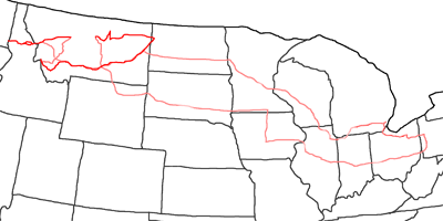
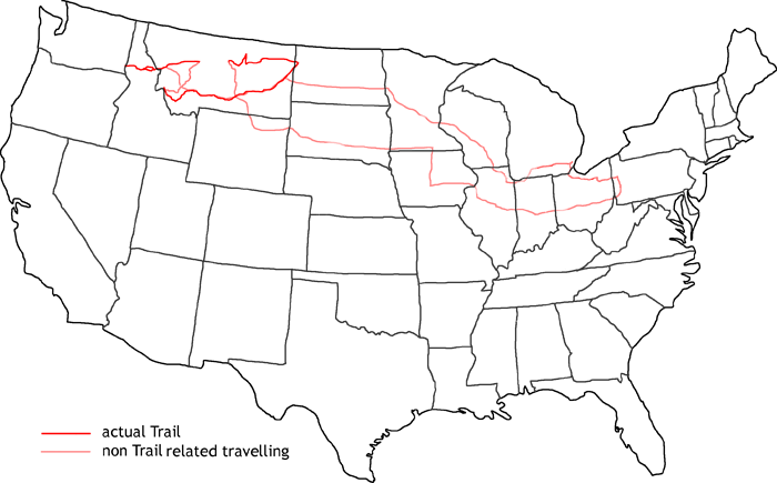
Map of Lewis and Clark Trail Back Home
In 2001 I am eventually able to finish the Lewis & Clark Trail, I started two years ago. In 1999 I was not able to travel the most interesting parts of this trail in Montana and Idaho due to the lack of an SUV. But since my car buy last year, this should be no problem now.
First I follow the Interstates from Pittsburgh to Missoula in Montana. There starts the part of the trail, which crosses the Rockies. I am back again in 1805, when Lewis & Clark were on their way to the Pacific. This part of the trail was the hardest part, they had to face. They followed an old Indian Trail, the Lolo Trail. But their Indian scout got lost and they went down into the Lochsa Valley. When they discovered their mistake, they already descended 1200ft. This distance they had to travel back up again. But it started to snow and the vegetation was so thick, that it was nearly impossible to proceed. Also the slope was extremely steep. This ascend took the last of their power. They were out of food and there was no game to hunt. Nearly the whole expedition has been wiped out at this place. But with the last exertion they made it to Weippe Prairie, where they met the friendly Nerce Perce Indians. They gave them food and saved their lives.
Even nowadays it is not possible to follow the whole ascend on forest roads. But you can get up to three quarts of the distance. Then you have to turn around and take another forest road to reach the main Lolo Motorway. But you should not be mistaken by the name Motorway to expect a nice paved road. It’s a one lane unpaved forest road with only a few turnouts. It is not uncommon to back up for half a mile to reach the next turnout.
I follow the trail to Lewistown/Clarkstown, then I turn back east. Now I follow the Trail in 1806 back from the Pacific. On their way back, they hit the right way over the pass. At Traveler’s Rest Lewis and Clark separated. Lewis followed a shortcut to the Missouri via Rogers Pass. The Indians, they met last year at Camp Fortunate, told them about this way.
Clark followed the same route, they went last year, to recover their burried canoes and dig out their provisions. This route goes via Gibbons Pass to Dillon and further on to Three Forks. From there he went on over Bozeman Pass to the Yellowstone River. Lewis & Clark planned to reunite at the confluence of Yellowstone and Missouri.
First I follow the route of Lewis up to the Graet Falls. Then I head back to follow the route of Clark.
At the end of my journey I still got some spare time, so I decided to follow some backroads along the Missouri Breaks, which I was not able to travel two years ago due to my rental car and the bad weather. On the Interstates I travel back to Pittsburgh.
- Day 1: August 12th, 2001 Munich — Pittsburgh
- Day 2: August 13th, 2001 Pittsburgh (Car Pick Up)
- Day 3: August 14th, 2001 Pittsburgh (Waiting for Car)
- Day 4: August 15th, 2001 Pittsburgh (Waiting for Car)
- Day 5: August 16th, 2001 Pittsburgh (Preparations)
- Day 6: August 17th, 2001 Pittsburgh (Preparations)
- Day 7: August 18th, 2001 Pittsburgh (Final Preparations)
- Day 8: August 19th, 2001 Pittsburgh — Champaign
- Day 9: August 20th, 2001 Champaign — Austin
- Day 10: August 21st, 2001 Austin — Rapid City
- Day 11: August 22nd, 2001 Rapid City — Whitehall
- Day 12: August 23rd, 2001 Whitehall — Missoula
- Day 13: August 24th, 2001 Missoula — Lolo Motorway
- Day 14: August 25th, 2001 Lolo Motorway (Day 2)
- Day 15: August 26th, 2001 Lolo Motorway (Day 3)
- Day 16: August 27th, 2001 Lolo Motorway (Day 4) — Clarkston
- Day 17: August 28th, 2001 Clarkston — Lolo Motorway
- Day 18: August 29th, 2001 Lolo Motorway — Missoula
- Day 19: August 30th, 2001 Missoula — Lincoln
- Day 20: August 31st, 2001 Lincoln — Great Falls
- Day 21: September 1st, 2001 Great Falls
- Day 22: September 2nd, 2001 Great Falls — Hamilton
- Day 23: September 3rd, 2001 Hamilton — Dillon
- Day 24: September 4th, 2001 Dillon — Livingston
- Day 25: September 5th, 2001 Livingston — Billings
- Day 26: September 6th, 2001 Billings — Hardin
- Day 27: September 7th, 2001 Hardin — Miles City
- Day 28: September 8th, 2001 Miles City — Glendive
- Day 29: September 9th, 2001 Glendive — Sidney
- Day 30: September 10th, 2001 Sidney — Glasgow
- Day 31: September 11th, 2001 Glasgow — Malta
- Day 32: September 12th, 2001 Malta — Billings
- Day 33: September 13th, 2001 Billings — Miles City
- Day 34: September 14th, 2001 Miles City — Fargo
- Day 35: September 15th, 2001 Fargo — Madison
- Day 36: September 16th, 2001 Madison — Chicago
- Day 37: September 17th, 2001 Chicago — Detroit
- Day 38: September 18th, 2001 Detroit — Pittsburgh
- Day 39: September 19th, 2001 Pittsburgh (Storage Preparations)
- Day 40: September 20th, 2001 Pittsburgh (Mine)
- Day 41: September 21st, 2001 Pittsburgh — Munich
