Lewis & Clark Trail
Day 28: September 17th, 1999 Williston — Glasgow
Again I am not convinced by the Continental Breakfast. But the restaurant I visited yesterday for dinner also has breakfast. So I give it another try. During my breakfast I watch an old Lady when she pulls into the parking lot. When she finished parking she opened the hood and took a wrench. A little bit later the car is back running again. Not bad for an old Lady — especially if you look how she is dressed up. Not really like someone working on cars!
I leave the restaurant and drive on to the gas station which I already figured out yesterady as the cheapest brand gas station. At half past eight and exactly in time I start the tour of today. First I hit Highway 2 West. Then I follow Highway 1804 along the Missouri. Just past Trenton I plan to be on the backroads. But the road is blocked. So I have to drive another mile until I can turn onto the backroads. But again I am not able to reach the river banks. Another “Private Property”–sign forces my to turn around. At Marley I am back on Highway 1804. It’s only a short drive until I am on the backroads again. But as before I am not able to drive all the way to the river and I have to turn around.
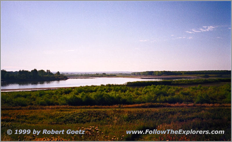
Confluence Yellowstone and Missouri River, ND
Now I am close to my first destination of the day: Fort Buford State Historic Site. Unfortuantely there is not much to see of the past. The spot is more a Camping– and Recreation Area. But at this time in the morning nooone is around. I leave the car to see the Lewis & Clark signs. Exactly at this spot the Yellowstone River enters the Missouri. Also at this spot the two parties reunited on their way back home. They separated across the Rocky Mountains to explore different water ways to the Pacific.
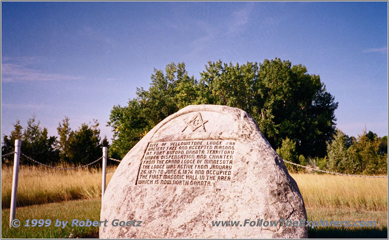
Fort Buford SHS, ND
I try to get some nice shots of the area. But I have to escape to the car pretty soon. It doesn’t take long for the mosquitos to figure out there is fresh prey at the river banks. And they start to attack me by hundreds. But I make it back to the car without big blood losses. When I leave the spot I encounter another sign to Fort Buford. I follow this sign and reach the main spot. First I hike through high prairie gras until I reach the historic site. In the gras I see signs of game who was roaming around in the early morning hours.
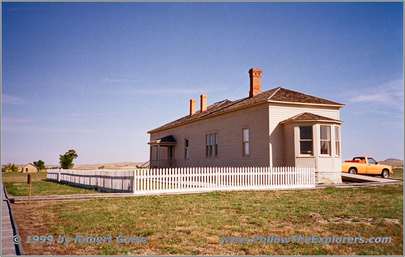
Fort Buford, Main Building, ND
On my way back to the car I am wondering if it is also possible to visit the small building. Almost noone is around. Only two cars are parked here. I give it a try and walk over to the building. It is really the rebuilt main building of the Fort. It was built from the remnants of Fort Union, which is my next destination. A Lady awaits me at the entrance door. I ask if it is possible to see the Fort. She says they are currently getting everything out of the house to renovate for the big Lewis & Clark bicentennial in 2004. But if I want to she can give me a brief tour of the house. She also says that there will be a big Interpretative Center built at the confluence of the Missouri and Yellowstone River. I am now the last visitor to this building for the next two years. She also tells me that a long time ago a famous Indian chief was arrested here. The exhibition shows life in the Fort at the old times. Everything is decorated with clothing and tools of the time. After the tour I give a big thank you to the Lady for making the exception for me.
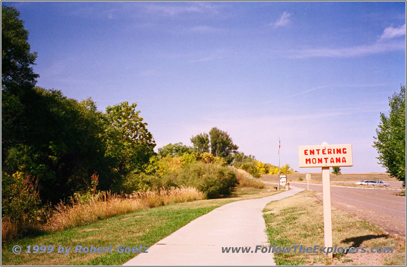
North Dakota — Montana State Line at Fort Union
Now it’s time to travel on to Fort Union. First I have to drive back to Highway 1804. Then it’s another mile to Fort Union. The crossing is already in Montana. But Fort Union is in North Dakota. When I hike to the Fort I cross the state line and also the timezone.
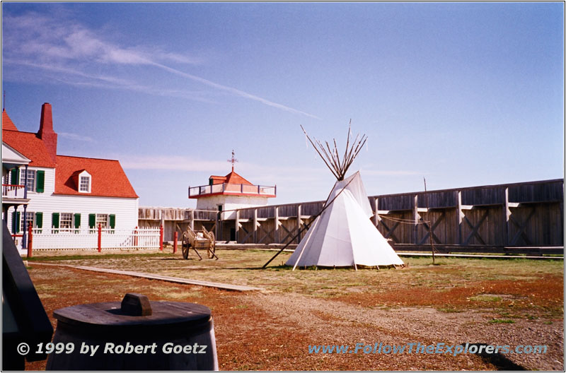
Fort Union Trading Post NHS, ND
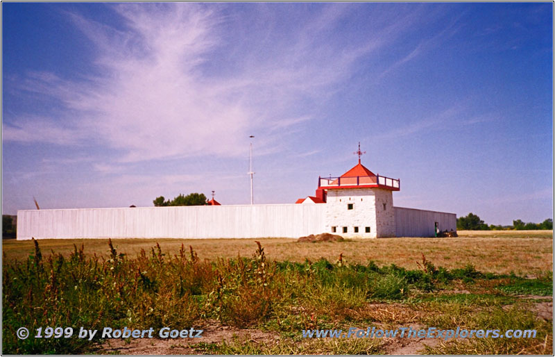
Fort Union Trading Post NHS, ND
The Fort was built in 1828 by the American Fur Company. It should become the main trading place for furs. But it didn’t took long until the beaver fur trading declined. But the tradeing with buffalo skins increased the same time. Also the river trading increased and gave Fort Union the chance to stay in business. A lot of Indians were the trading partners at this time. In 1837 trading declined dramatically because of smallpox. But it recovered soon. In 1857 another smallpox epidemic forced the Indians to escape and trading declined again. Also the settlement of the area started. In 1864 the Fort was in real bad shape. A General, who spent the winter here, wrote that the Fort is almost falling apart. In June 1866 a new infantry arrived and it was decided to build the new Fort Buford at the spot of former Fort Williams. Fort Union has been sold to the Northwest Fur Company, who tried to start trading in the area again. But they had no success and sold the Fort in 1867 to the army. The troups teared down the Fort and used the parts to build Fort Buford. Only the foundations survived. In 1966 the area was bought by the National Park Service. In the meantime the whole area was covered by gras. First they had to excavate the foundations. From 1985 to 1991 they built the whole Fort with outside walls, main entrance facing south to the river, another entrance facing north to the prairie and the Bourgeois House.
During my filming of the inside of the Fort a rabbit runs through the Fort. This one I also have to tape. But there is not enough time to also take a picture. Then I visit the Bourgeois House. The exhibition shows the history of the Fort. Also the usual gift shop is here. I leave the building at the north entrance and video tape the bell tower. Then I leave the Fort at the north entrance. I have a chance to enjoy the view of the prairie before I hike back to the car. It’s already one o’clock and I am one and a half hour behind my schedule. It’s also getting hot again. The sun still has a lot of power even with the cool mornings.

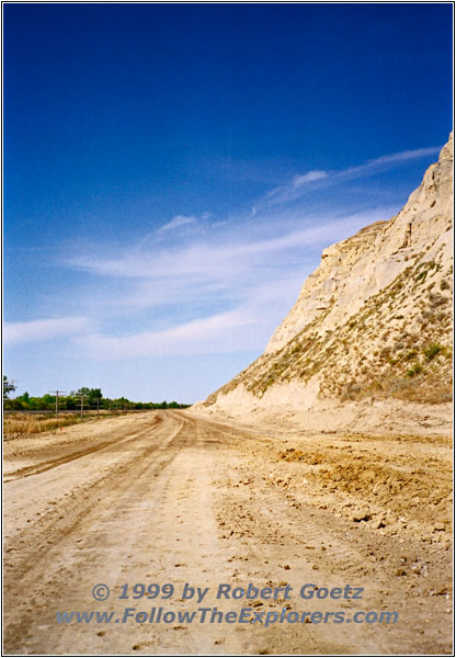
Highway 327, MT
Around 1pm I am back on Highway 1804 which is Highway 327 in Montana. Also the black top has ended. After a couple of miles I have to stop at a road construction. I chat with the lady who helds the stop sign. She tells me that the road will be widened and paved for the big Lewis & Clark Event. Just the day before a writer passed by who writes a book about the trail.
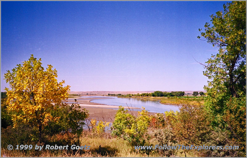
Missouri River, MT
After 10 minutes I am able to proceed. I follow Highway 327 — or better the dirt road — until I reach my backroad to Bainville. I drive on this little road up to Bainville and from there on Highway 2 to Culbertson. I turn onto Highway 16 and cross the Missouri.
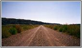
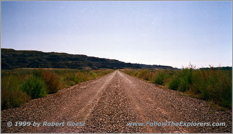
Backroad, MT
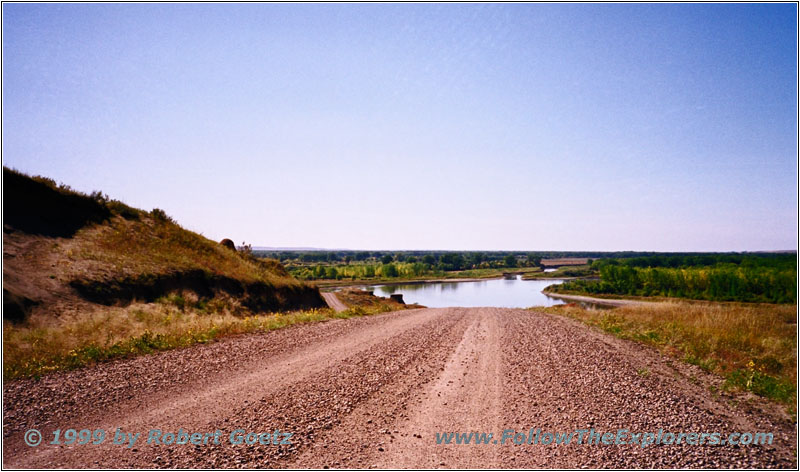
Missouri River, Backroad, MT
Just past the bridge Highway 152 takes me to the West. Now I follow a lot of small dirt roads along the Missouri. In some areas I have to leave the river for a while when there is no road along the banks. After a while I reach Highway 13 which I follow for another mile. I turn onto Highway 528 which is paved at the beginning. But soon the pavement ends again.
A warning sign at the side remembers that the road is only passable in dry conditions. I am lucky because there is plenty of sunshine today and I am able to drive the dirt road. Suddenly I reach a road closure again. But there is a small detour build to circle around the construction zone.
But on this detour a group of cows had settled down and it took a while to convince them to leave the road. Now I am really in the backcountry…
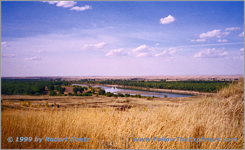
Missouri River, MT
Sometimes there are real great views of the Missouri River. At one spot I break suddenly to jump out of the car to take a photo. This is possible on the backroads as usually noone is around. When I return to my car an old and rusty van drives up the hill. The two guys stop and ask if everything is ok. They have seen me stopping suddenly and jumping out of the car and are wondering if everything is alright. I am pretty impressed! These two guys don’t really have much but are willing to help immediately any stranger!
I tell them that I have just stopped because of the beautiful view of the river. When I tell them that I am from Germany they are really surprised. Usually this is not a road to expect tourists. He asks me about the destination of my journey. When I tell him Seattle he is even more excited. His daughter works at the Space Needle. This is also where I plan a visit. After a brief talk we say goodbuy. It’s simply great on the backroads. Everyone helps everyone!
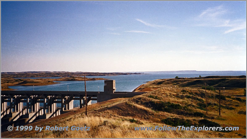
Fort Peck Dam, MT
Soon I reach Highway 24 which I follow to Fort Peck Dam. This is the last visit for today. In 1933 president Franklin D. Roosevelt agreed on building the dam. It was the first one on the upper Missouri River. It was the future for thousands of workers fighting the big depression. They started in 1934 and had the maximum amount of workers of 11,000 in 1936! In 1940 they finished after seven years the building of the dam.
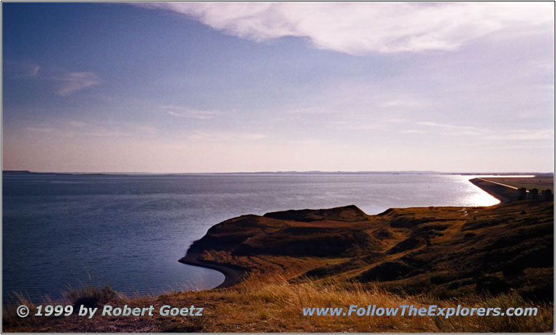
Fort Peck Lake, MT
I enjoy the view of Fort Peck Lake and the Missouri before I cross the dam on Highway 24. I follow the highway to Highway 42 which takes me up to Glasgow. This is my final destination of today. But I am not able to find a Motel which really convinces me. Eventually I stop at the Star Lodge Motel at the west end of the city. I ask where I can have dinner tonight. She says the restaurant across the street is good. I thank her and put my stuff into the room. The rooms are not fancy but clean. Only the door is not really trustworthy. After I made it to lock the door from outside I cross the street to visit the recommended restaurant. Unfortunately it is just fast food — not really what I am looking for. But I am really tired and therefore I order fried chicken. Unfortunately it also tastes like I expected it. After I have finished I hike back to the Motel. I hope my breakfast tomorrow will not be as bad…
- Sights
- Fort Buford SHS
- Fort Union Trading Post NHS
- Fort Peck Dam
- General
- Breakfast: Western ND Restaurant, Williston
- Dinner: Fast Food, Glasgow
- Motel: Star Lodge Motel, Glasgow
- Distance: 222 miles
