Lewis & Clark Trail
Day 34: September 23rd, 1999 Helena — Dillon
I plan to start around eight. But I sleep in. It’s almost nine when I leave JB’s after a big breakfast. The gas station is across the street and I start my trip around nine with an hour behind my schedule.
I will pass Canyon Ferry Lake at the east side. This lake is build up by the Missouri waters. Highway 284 follows the lake shores very close. First I drive Highway 430 to the lake. Suddenly the pavement ends and I am on a dirt road again. The pavement soon returns with Highway 284 and the road along the lake is awesome. There is not much traffic for a working day. This gives me the opportunity for plenty of movie stops. I cross the Missouri at the south end of the lake and reach Townsend. I plan to follow the Missouri along the River Road but I hit the wrong crossing at Townsend. Suddenly I am at the trainings property of the National Guard. To avoid to be their next target I immediately turn around and leave the area.
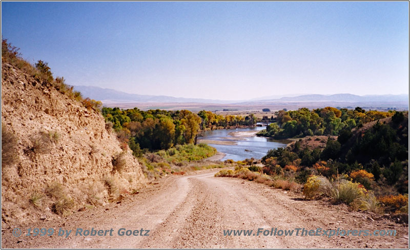
Toston Dam Road, Missouri River, MT
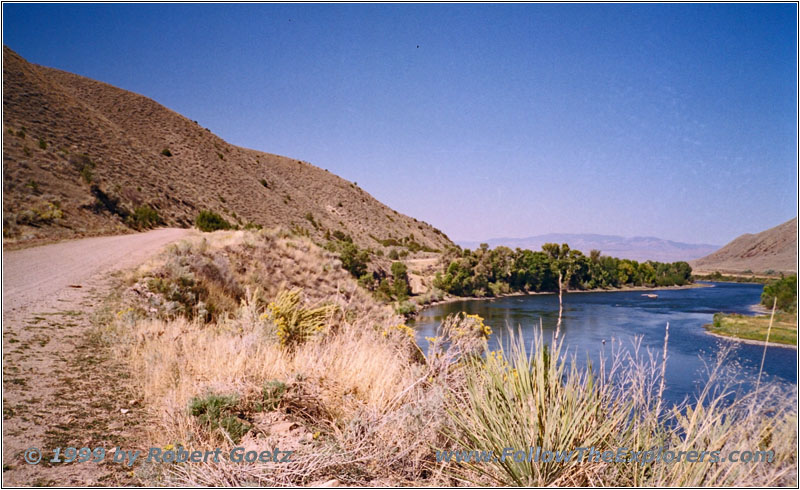
Toston Dam, Missouri River, MT
After driving a short distance downhill I reach the correct crossing to the River Road. This road follows the Missouri several miles along the hill. This gives me great views of the Missouri valley. This dirt road is one of the most scenic drives I had on the whole trip. But as usual the nice drives are always too short and I reach Highway 287 again. I follow the Highway only a small distance before I turn onto the next dirt road to Toston Dam. This is the last opportunity to follow the Missouri River closely. The river flows through a beautiful desert canyon. Unfortunately this road is only a spur road and at the dam I have to turn around and drive back to Highway 287.
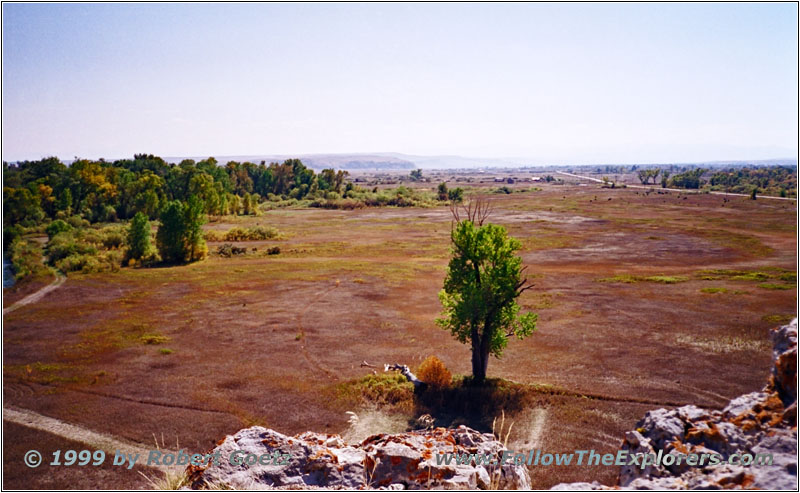
Missouri Headwaters State Park, MT

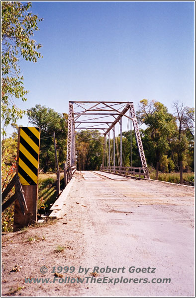
Logan Trident Road, MT
This Highway is following the river in some distance through the planes up to Three Forks, the source of the mighty Missouri River. My next destination is the Missouri Headwaters State Park. But a road closure forces me once again to drive a detour. I go to Logan and follow the Logan Trident Road to Trident, which is again a dirt road. Highway 286 takes me to Fort Rock. A small hiking path goes up the hill. From their I have a great view to the Lewis Rock on the other side. Lewis draw a map of the region from this rock. I am also able to see the confluence of the three rivers which form the Missouri: The Jefferson, the Gallatin and the Madison.
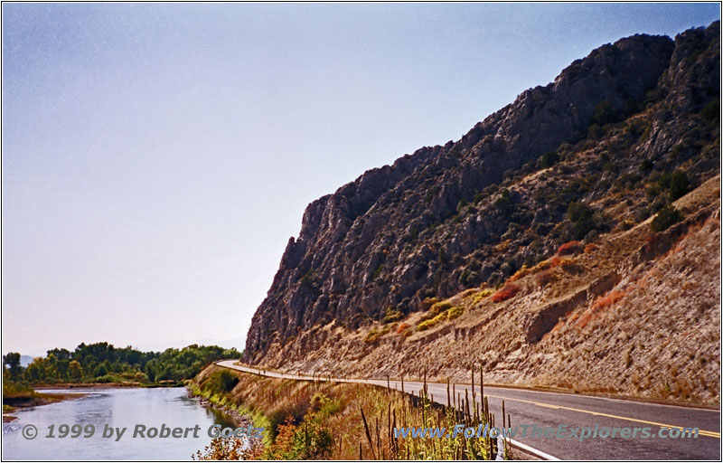
Jefferson River, Highway 287, MT
The explorers followed the Jefferson which is named after presdient Jefferson who gave the orders for the expedition to explore the country. I try to follow the river on Highway 287 and Highway 2 as close as possible. I am already hopelessly behind my schedule. Beside the one hour delay this mroning I spent another hour more than planned in the park. I have to hurry up if I want to have a chance to visit the Lewis & Clark Caverns.
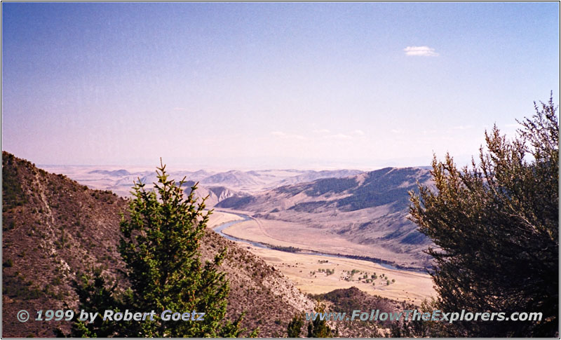
Jefferson River Valley, Lewis &Clark Caverns State Park, MT
I make it just in time for the last tour this day. But I run out of time to get my jacket from the car and I have to do the trip just with my shirt. The entrance to the cavern is on the mountain. I have a great view from there down the Jefferson River valley. Just a last view shots from the area and then we enter the cavern. But Lewis & Clark have never seen this cavern. It was just named in honor of them. The only thing that point to this cavern from Lewis’ records is that they saw a smoking mountain. In fact there is an opening in the cave where wet air can leave. Depending on the weather it is possible to see this wet air as smoke.
Around 1900 the first guided tours have been through the cavern. At this time they had no electrical light but torches. The guide and owner was a Scotsman who was the only one in the group with a torch. Unfortunately the protection of the nature and the knowledge about dripstones was not very deep. Instead he encouraged his visitors to take some dripstones with them and spread the word about his cavern. He thought they would grow back within a couple of years. But in reality these stones need several hundred to thousand years to grow. Even today you can see the damage from this time. It can also be seen which stones have been touched. Due to the skin grease no water will stick on the dripstone anymore and therefore it cannot grow any further.
There is also a small lake in the cavern which fights with the leftover of the former times. The color is green — but not made from nature. The owner encouraged people to throw coins in the lake for wishes. In the evening he got the coins back out but the copper is still left in the lake and turns it color to green.
Later the cavern has been put under control of the park service and closed by a gate. But that did not stop the owner. Every spring he took the gate out which has been renewed in the fall by the park service. This went on for several years until they found an agreement. Nowadays the tours are carefully organized to pretend the cavern for later generations. Also the light will be only turned on for a single stretch where the group currently is. At the entrance of the cave are some light sensitive animals living. Therefore it is not allowed to use flashlights there.

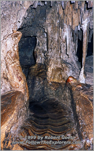
Lewis & Clark Caverns, MT
The cavern is kept very primitive. There are stairs and steps in some areas but a lot of times you have to walk on slippery rocks. At the beginning is the so called “Beaver Slide”. If you are good you can try to go down in a squat. If not you have to sit and slide down. But due to the wet ground you are “branded” with a wet boody for the rest of the tour…

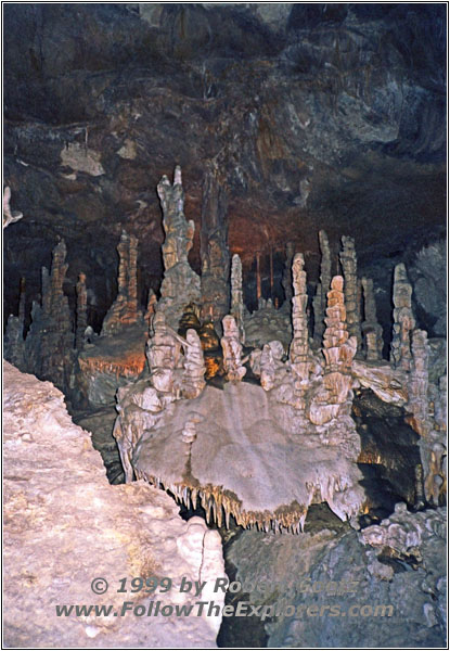
Lewis & Clark Caverns, MT
I am lucky to be in a very small group. This gives the guide the opportunity to tell a lot of details. Also some of the dripstones look like figures when you put the light in a certain direction. They can then tell their own stories.

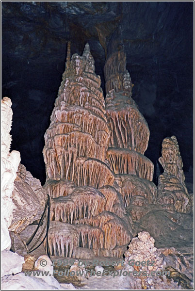
Lewis & Clark Caverns, MT
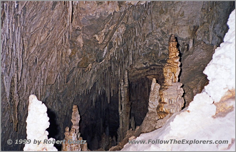
Lewis & Clark Caverns, MT
We go deeper and deeper into the cavern and it is getting more and more wet and cold. Amazingly I am not freezing even with only my shirt on. Also the other guys from the group cannot understand that. The whole tour lasts for an hour.

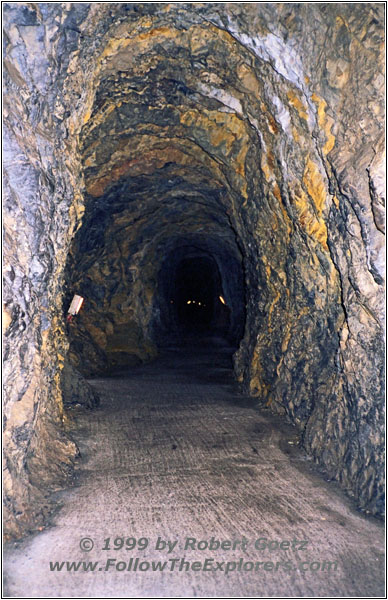
Lewis & Clark Caverns, MT
At the end we are at a heavy door. Our guide explains that this exit was originally not there. They blowed it carefully in the rock to have a round trip for visitors. They had been very carefully to not damage anything in the cavern due to the blast. When they finally had the end open a storm with more than 60mph went through the cavern and started to immediately dry everything out, endangering the whole cavern. Therefore they put two heavy sealed doors at the end which act now like an air lock. This keeps the wet air in the cavern.
At the exit I make a brief movie stop before I return around 5pm to my car. The entrance of $11 ($7 for the cavern, $4 for the park) was not cheap but really worth the money. Despite other caves I have visited before this cavern is not too touristy. You still feel a little bit like a pioneer when walking through the cavern.
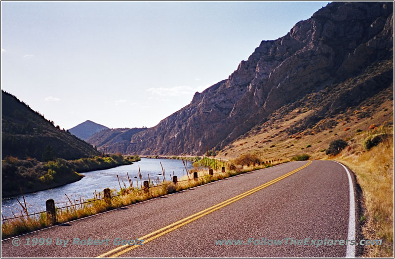
Jefferson River, Highway 2, MT
I drive back down the mountain and follow Highway 2 to Whitehall. There I turn onto Highway 55 and drive up to Parsons Bridge. Highway 422 takes me to Twin Bridges. From there I follow Highway 42 to Beaverhead Rock.
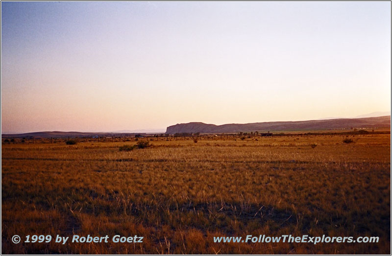
Beaverhead Rock, MT
Sacagawea recognized on August 9th, 1805, this long hill. With a little bit of fantasy you can really recognize a swimming beaver. Her tribe usually should be in this area or across the Continental Divide. The guys were happy to be on the right path.
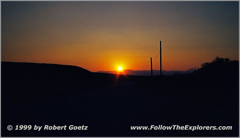
Sunset Riverside Drive, MT
In the meantime the sunset starts and I get some nice shots from Beaverhead Rock. Then I drive on Highway 41 to Dillon and my destination for tonight: The Super 8 Motel. I talk a while with the lady at the reception about my trail. She is so amazed of this that she gives me a very special price for the night. She also recommends the Blacktail Station for dinner. They have great steaks. First I miss the restaurant three times before I eventually see it. The restaurant is in the cellar. It looks very nice but is also a bit pricy. I order a real great steak and enjoy my dinner. It’s pretty late when I leave the restauarnt and return to the motel.
- Sights
- Missouri Headwaters State Park
- Lewis & Clark Caverns State Park (Fee $4)
- Lewis & Clark Caverns (Fee $7)
- Beaverhead Rock
- General
- Breakfast: JB’s, Helena
- Dinner: Blacktail Station, Dillon
- Motel: Super 8, Dillon
- Distance: 222 miles
