Lewis & Clark Trail
Day 39: September 28th, 1999 The Dalles — Portland
The Continental Breakfast at the motel did not look too bad so I give it a try. I plan to start early and this saves me a bit of time. Pretty much on time I drive to the next gas station. When I arrive an attendant shows up and filled the tank for me. When he sees my asking look he says that is service at this time. Maybe it is also due to the cold — we are in the mid 30s again.
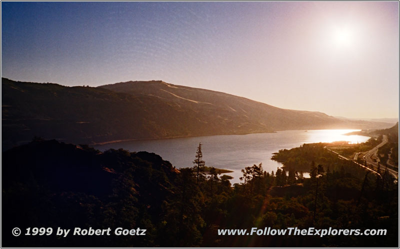
Columbia River, Highway 30, OR
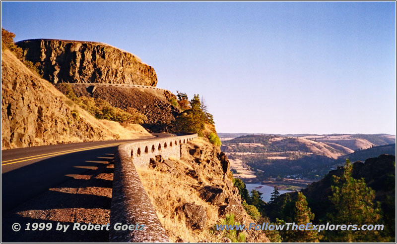
Rowena Crest Viewpoint, Highway 30, OR
I start my tour not on Highway 14 on the north banks but on Highway 30 on the south bank of the river. I have seen a documentary about this highway yesterday in the Discovery Center. The road had been built without removing any tree. Also the landscape has been changed as little as possible. The road has been built literally into the landscape. A nice viewpoint along the road is Rowena Crest Viewpoint. I could drive on roads like that forever. Unfortunately at Moster the highway ends and enters I–84.
Now I am driving at Interstate speeds to Cascade Locks. I almost didn't encounter the sudden change in the landscape. Within an hour the dust hills with prairie gras are gone and a landscape rich on trees, bushes and moss takes over. Now I reach the Pacific weather. I can really feel the increase in humidity.
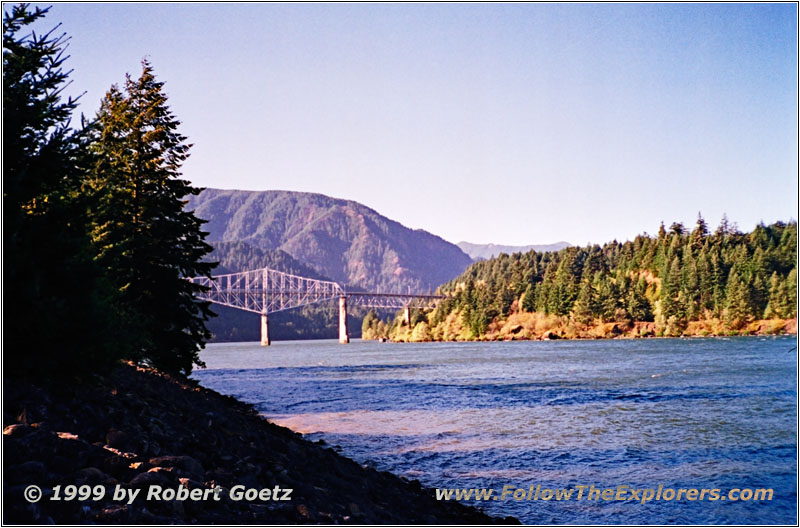
Bridge of the Gods, Columbia River, Cascade Locks, OR
I do a stopover at Cascade Locks. My plan is to join the Lewis & Clark Cruise. But it is extremely windy. When I arrive I have to realize that all cruises are canceled due to the stormy weather. I can only hike to a small island which is connected by a pedestrian bridge. The wind almost blows me of the bridge. It is so strong that you have to walk in an angle. I find a spot which is a little bit hidden from the wind on the island to take pictures and movie from the Bridge of the Gods. At this place the Columbia has washed out a tunnel between the mountains which are only a couple of hundred yards apart. Over time this natural bridge collapsed. Today a bridge connects both sides which has been finalised in 1926. Due to the dam in Bonneville the whole bridge had to be lifted. They started it in 1940 and lifted the bridge by 40 feet.
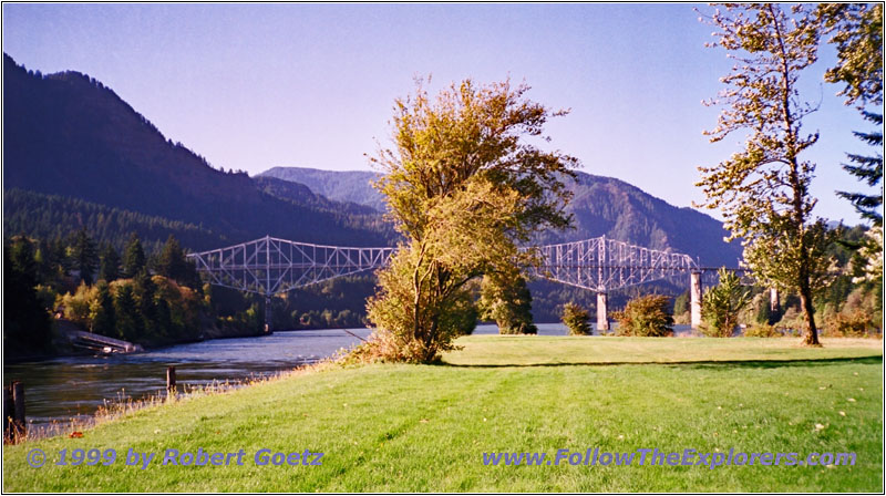
Bridge of the Gods, Thunder Island, OR
The bridge got its name from an old Indian legend. Manitou built this bridge and sent as keeper an old and wise woman named Loo–Wit. He also sent the big snowy mountains which were his sons: Multnomah, the warrior, Klickitat (Mt. Adams), the totem maker and Wyeast (Mt. Hood), the singer. Everything was fine until the beautiful Squaw Mountain entered the valley between Klickitat and Wyeast. Although she felt in love with Wyeast she had a lot of fun to flirt with his older and bigger brother Klickitat. First the two brothers fighted with words. Then they stomped their feets. Finally they started to through fire and ashes until the dark smoke hided the sun. They threw hot stones which ignited the surrounding forests and forced the people to fled. They also threw the stones on the bridge and started earthquakes until the bridge collapsed and fell into the river. When Manitou heard of that he was so angry that he also started an earthquake. Eventually Klickitat won the fight between the two brothers and Squaw Mountain had to take her place at his side whereas she was still in love with Wyeast. Within a short amount of time she fell asleep at his feets and never woke up again. Today she is known as the Sleeping Beauty west of Mt. Adams. At this time Klickitat had his head high as Wyeast. But because Squaw Mountain was in love with Wyeast he dropped his head and never raised it again due to ignominy.
During the fight Loo–Wit, the keeper of the bridge, tried to finish the fight. But she was also hit by stones. When the bridge collapsed they fell together. But the Big Spirit heard of her efforts and she got one last wish. Her wish was to be young and beautiful again and she took her place between the snowy mountains. But she was older in spirit than the others. So she left and moved on to the west. Nowadays you can find her as Mt. St. Helens, the youngest mountain in the Cascades.
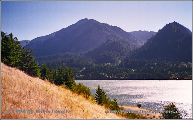
Columbia River, Bonneville Dam, WA
I continue my journey over the “Bridge of the Gods”. The expedition had to carry their whole equipment around these rapids on November 1st. I follow Highway 14 to Bonneville Dam. There is again a nice viewpoint of the Columbia River.
Beacon Rock, Highway 14, WA
Columbia River, Beacon Rock, WA
After I took some pictures I continue to Beacon Rock State Park. This dark rock really looks a bit like a beacon which is standing alone in the landscape. Nowadays it is easy to climb the 850 feet rock. On all critical spots are wooden paths with guard rails. But even with this assistance you don’t feel comfortable when the storm is almost blowing you off your feet. Especially the east side is stormy. It is hard to keep the camera calm to take pictures and movie. On my way back I run into a guy with climbing gear who planned to climb this rock. But he says with the wind today it would be suicide to do so. I totally agree…
Columbia River, Beacon Rock, WA
Columbia River, Beacon Rock, WA
When Lewis reached this place on November 1st, 1805, he saw the tide for the first time. This was important news. Now they thought the destination of their journey, the Pacific Ocean, cannot be very far away.
I leave Beacon Rock around noon and drive on Highway 14 to Vancouver. I cross the Columbia River to Portland on I–5. I plan to drive back on Highway 30 to Troutdale. But the signs are pretty bad and I am meandering for a while through Portland until I reach the Highway. I feel I am now in a big city again. All the coziness from the backroads I had the last couple of days is gone. When I reach Troutdale I check in at the Motel 6. It’s not yet 2pm and I am perfectly in time. I hurry up because I still want to visit Multnomah Falls.
I drive on the Interstate to the falls. But on my way back I want to drive the Scenic Highway. The parking lot for the falls is between the two Interstate roads. There is a pedestrian underpass to reach the falls. When I arrive at the other side I see that there is also a parking lot which can be reached when driving the Scenic Highway.

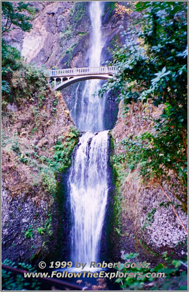
Multnomah Falls, OR

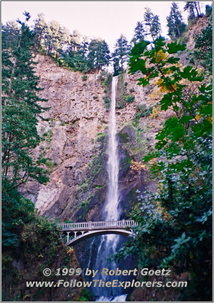
Multnomah Falls, OR
I hike on to the falls. Unfortunately I have to realize that I am now in a tourist area. Everything is extremely crowded and it is hard to catch a nice spot to take pictures. The falls are separated in two. There is a small bridge in the middle which crosses the small pond built from the falls. Up there the tourists are already less and it is easer to get a nice shot.

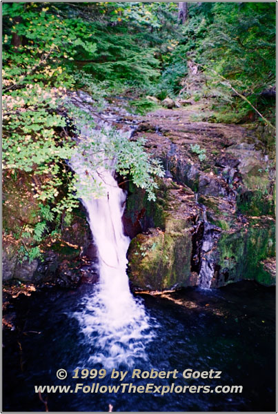
Multnomah Falls, OR
On the other side the hiking path continues to the top of the 600ft Multnomah Fall. This is the highest fall in the Columbia Gorge area and one of the highest in the US. When I reach the top almost all tourists are gone. The steep incline on the paved hiking path is already too much for most of them — lucky me.

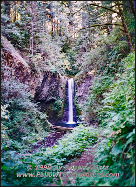
Larch Mountain Trail, Multnomah Creek, OR

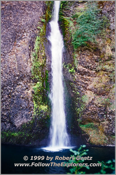
Multnomah Falls, OR

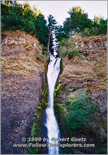
Multnomah Falls, OR
I discover another hiking path which follows the upper river. It is the Larch Mountain Trail. This is where the pavement ends. I hike through mossy forests along the creek. From time to time there are small water falls and little ponds. It is really a nice area for hiking. It’s easy to spend days hiking here. I completely forget the time and I have to hurry up to be back at my car during daylight. When I reach the parking lot the sun is already low.
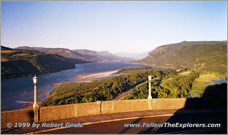
Columbia River, Crown Point Vista House, OR
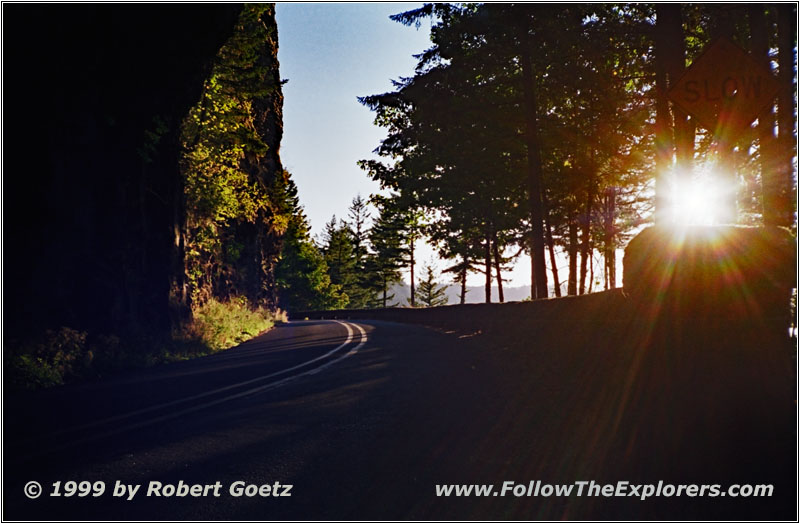
Historic Columbia River Highway, OR
I hope there is still time to see something of the beautiful Highway which I plan to drive back. First I have to travel on the Interstate for several miles before I reach the exit. Then I drive the Historic Columbia River Highway back. On this way are several other waterfalls were I make brief stops. Then the road climbs up to the Crown Point Vista House. Unfortunately the building is already closed. When I try to exit the car the storm almost blows me away. It is already hard to walk. I take a couple of pictures. Then I seek shelter in my car again. I can really feel how the wind shakes the whole car.
I continue my way back to Troutdale. Now it’s time to search for a restaurant. I drive almost an hour through the area but there is nothing nice in sight. I end up at the Mrs B’s close to my Motel. It is one of these typical family and trucker restaurants with good food and reasonable prices. I think I will also have breakfast here tomorrow. It’s almost 10pm when I leave the restaurant and drive back to the motel.
- Sights
- Rowena Crest Viewpoint
- Cascade Locks
- Bridge of the Gods (Fee $0.75)
- Bonneville Dam
- Beacon Rock
- Multnomah Falls
- Crown Point Vista House
- General
- Breakfast: Super 8, The Dalles
- Dinner: Mrs B’s, Troutdale
- Motel: Motel 6, Troutdale
- Distance: 224 miles
